Drones, drones and more drones. As the proliferation of UAV (unmanned aerial vehicles) technology grows, so too does the construction industry’s use of them as valuable jobsite tools. According to Drone Base’s Christopher Grillo, “Construction reigns supreme in drone adoption, showing increases in usage of 239% over the last year.”
As the industry continues to look into drone value for the jobsite, many firms are exploring the possibilities. Texas-based general contractor Rogers-O’Brien was an early adopter of drone technology, under the guidance of Todd Wynne and Joe Williams, now VPs with Bluebeam.
“When I came to Rogers-O’Brien, they already had a pretty substantial drone program in place,” explains Rogers-O’Brien VDC Specialist James Holmes. “Joe and Todd had done a phenomenal job of making a strong push for that technology. And fortunately, we have very forward-thinking senior leadership that doesn’t look for obstacles to prevent us from doing things. But rather does a really fantastic job of encouraging us to find new solutions.”
These solutions have helped Rogers-O’Brien find value in the usage of drones. “In addition to site logistics, we’ve started using it a lot for quality control and field verification of work in place,” Holmes relays.
Mitigating costly rework
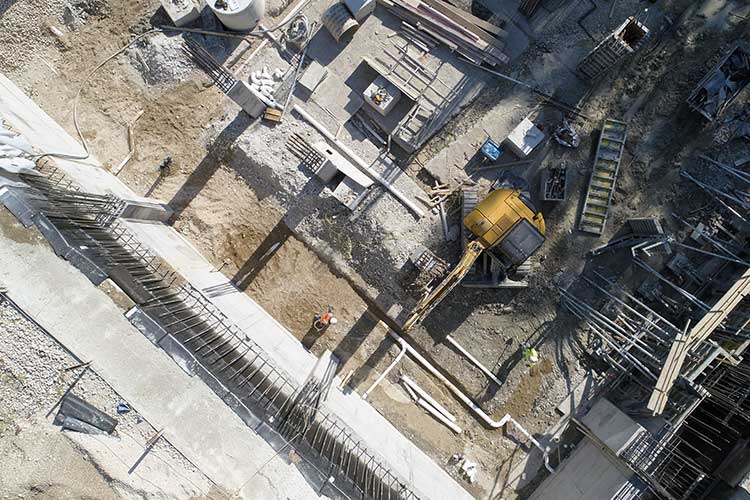
Mitigating rework has been a byproduct of work verification and drones have helped the firm avoid some potentially expensive issues. While working on a data center, drone capture proved itself on a concrete pour.
“We had poured the slab on grade and we had a whole bunch of plumbing stub outs in the office areas and a couple for processed water,” explains Holmes. “However, for whatever reason, the stub outs had been cut short prior to the concrete pouring. This wasn’t identified. So they ended up covered in concrete and the subcontractors didn’t know where they were.”
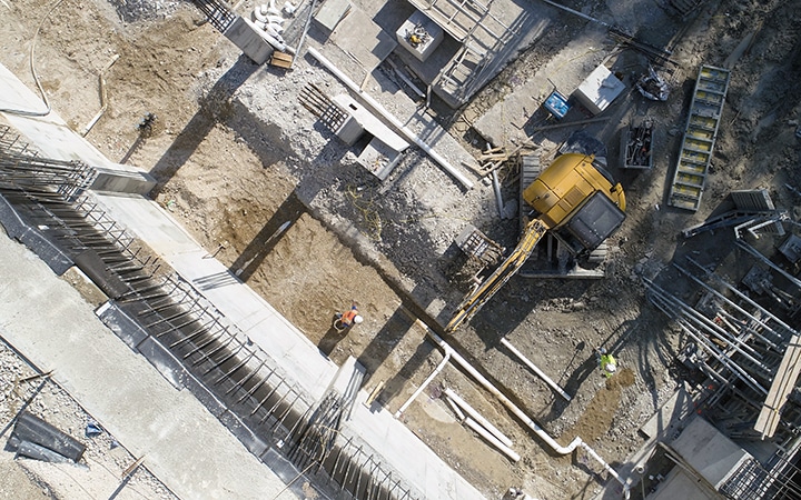
Fortunately, the drone capture provided a big answer. “We had been flying the drone two or three times a week out on that project and were able to go review that imagery and locate every single one of the penetrations coming up. They were able to go out there with a hammer, just chip down through a half inch of concrete or whatever. And sure enough, there they all were.”
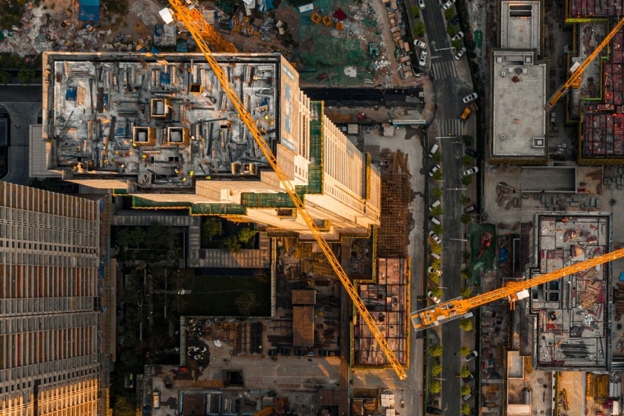
Rogers-O’Brien experienced a similar situation on a 19-story student housing high-rise at a major university. “We had placed all these sleeves for a section of concrete pour and flown the drone over, overlaid the architectural plans with it,” says Holmes.
“We realized that we had something like eight sleeves that were all supposed to be in a wall that were just in the wrong spot. Someone read a tape wrong or pulled from the wrong control line, and those eight sleeves would have been in the wrong spot.”
“It was a high-rise job, so it’s all post-tension concrete and these sleeves sat on either side of some PT cables. So, if they have it in place, it would’ve been very difficult, if not impossible to go to where those sleeves should have been and core out the concrete to place them in place. We would have had to do some rework on the MEP coordination to relocate those.”
Saving money with opportunities
Drones have not only showed value for Rogers-O’Brien in mitigating rework, they have also helped the firm capture potentially missed opportunities and hard dollar savings. One project required the excavation of a very large utility trench, around 10 feet deep and 20 feet wide. After the trench was dug, the utilities were installed with room to spare.
“Once they’d laid in utilities that had to go into place, they looked at the aerial imagery and realized they had room to fit another utility in there, so that utility no longer had to have a separate trench dug at a different date. They were able to just come in and install that particular utility in parallel with the other system,” Holmes recalls. By no longer needing a separate trench and installation, the company saved around $600,000. “Needless to say, that aerial imagery was quite helpful.”
Safety for workers
The versatility of drones also makes them a great tool to minimize risk and increase safety for trades workers and jobsite stakeholders. Case in point, inspections on high-rise projects.
“We’ve performed at least four or five inspections that I can think of that would have meant the mobilization of swing stages and hanging people 300 feet above downtown Austin to go check some flashing,” Holmes says. “Instead, we just grab a drone and 10 minutes later we have very high-resolution images that we can share with all of our stakeholders, get off to third-party consultants and get to our own in-house risk management experts.”
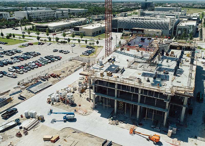
“They can review all that quickly, mark it up. And that way if we do have to go out and make a repair, at least it’s a one-stop shop for that swing stage. Instead of going out, setting up to do an inspection and then leaving it in place for several weeks, maybe several months, while we wait to find out a solution or re-mobilize.”
Automation and safety are also becoming drone-assisted aspects of jobsite progress. In that regard, Holmes doesn’t see drones as a job killer in any way, rather, he believes the platform can be valuable towards safety.
“Humans are great. We do a lot of things that computers can’t. But one of the things we don’t do well is identify exactly where a drone is whenever it’s 1,500 feet away from us and 200 feet up in the sky. I have a lot more faith in the drone itself to figure out where it is and make sure it’s not doing anything strange. We’re pushing towards that automation and safety at the same time,” explains Holmes.
Drones and Bluebeam Revu
Using Bluebeam Revu in tandem with drone capture gives Rogers-O’Brien some distinct advantages and controls to ensure drone success. “Aerial imagery with Bluebeam allows the project teams to go in there and very easily lay out site areas,” says Holmes. “We have several jobs that have site maps with Bluebeam markups all over them.”
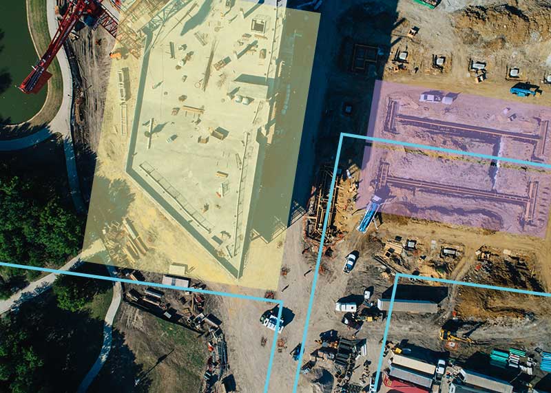
As a part of Roger-O’Brien’s tech stack, Revu has become the go-to solution for maximizing the use of drone technology. Holmes cites the proliferation of Revu throughout the industry as a major advantage to using it to capture drone-based deliverables. “Everyone has it and they know how to use it,” Holmes says.
‘Drone imagery is fantastic. It’s a great insight, but the inclusion of Bluebeam really allows it to show its true value. At that point in time it’s no longer just a bunch of pictures that look pretty, it’s something that we can actually make actionable with accurate information.’
Rogers O’Brien VDC Specialist James Holmes
“On the orthomosaic map end of things, there are some software companies that are working with us to have direct integration with Bluebeam and the fact that they export PDFs is definitely a huge help. Revu allows us to have those very large site maps but maintain manageable file sizes.”
“JPEGs and the PNGs and all those image formats are great, but they’re not always universally compatible with iPhones, iPads, different computers or web browsers. But PDFs by design, work pretty well across the board. The fact that Bluebeam functions so well with PDFs is really a key part of why it’s as useful as it is for drone capture,” says Holmes.

